Inland Waterway
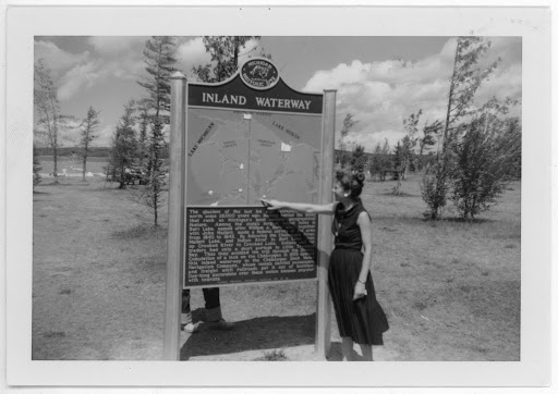
The glaciers of the last Ice Age retreated to the north some twenty-five thousand years ago, leaving behind the lakes that rank as Michigan’s most notable geographical feature. Among the state’s largest inland lakes is Burt Lake, named after William A. Burt, who, together with Henry Mullett, made a federal survey of the area from 1840 to 1843. By following the Cheboygan River, Mullett Lake, and Indian River to Burt Lake, then up Crooked River to Crooked Lake, Indians and fur traders had only a short portage to Little Traverse Bay. Thus they avoided the trip through the Straits. Completion of a lock on the Cheboygan in 1869 opened this inland waterway to the Cheboygan Slack Water Navigation Company, whose vessels carried passengers and freight until railroads put it out of business. Day-long excursions over these waters became popular with tourists.
Plaque via Michigan History Center