Council Point / Pontiac's Council

On April 27, 1763, Obwandiyag, an Odawa who was also called Pontiac, assembled a council of warriors from various tribes near this site. He urged them to fight to maintain control of their land and their way of life. For more than a century, tribes in the Ohio Valley and the Great Lakes had allied themselves with different European nations that fought to dominate the Great Lakes. Most favored the French, trading partners who were not very numerous, instead of the British, whose policies and exploding population were a threat to Indian existence. After the French lost the Seven Years’ War (1756-1763), the tribes faced a single European power: Britain and its colonies. Their resistance began almost immediately with attacks on posts and forts.The Native American council that met near this site on April 27, 1763, included members of the Odawa, Potawatomi, Wyandot, Huron and Ojibwa bands. Pontiac told of Delaware prophet Neolin’s vision of resisting the British and returning to traditional ways. The resulting plan to surprise and seize Fort Detroit on May 7, 1763, became a siege lasting nearly six months and involving more than 900 Great Lakes warriors. That summer thirteen other British posts were attacked. At Detroit, on July 31, the British attempt to engage the Indians failed disastrously at Bloody Run. In October, the French declined to provide support, and warriors returned home to their families. The siege ended, but the tribes’ fight for their homelands and their rights continued.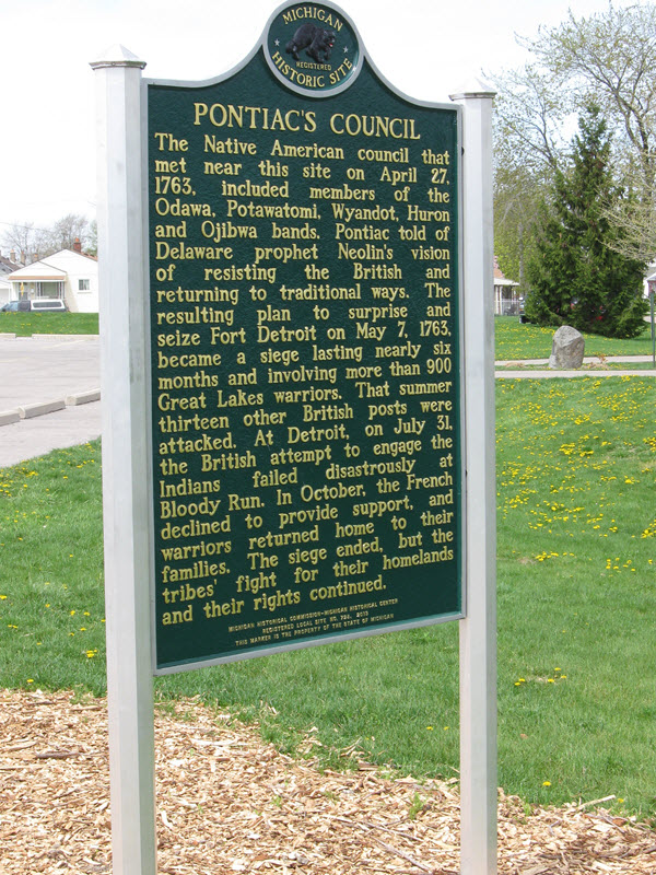
Plaque via Michigan History Center