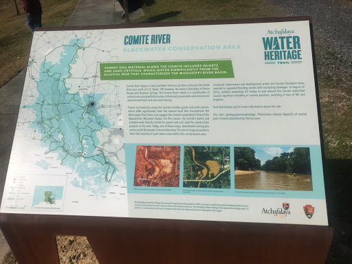
Comite River - Blackwater Conservation Area
Parent soil material along the Comite includes quartz and sand crystals, which differ significantly from the alluvial mud that characterizes the Mississippi River Basin.
The Comite River begins in East and West Feliciana parishes and joins the Amite River just north of U.S. Route 190 between the eastern boundary of Baton Rouge and Denham Springs. The Comite River’s basin is a combination of natural areas along with the human-influenced conservation and commercial areas formed from rock and sand mining.
Parent soil materials along the Comite includes quartz and sand crystals, which differ significantly from the alluvial mud that characterizes the Mississippi River Basin and suggest the Comite’s watershed is that of the Appalachian Mountain Range. For this reason, the Comite’s banks and riverbed were heavily mined for gravel and rock used for construction projects in the area. Today, one of these large, abandoned mining pits serves as the Blackwater Conservation Area. The mine’s large excavations form the majority of open water areas within this conservation area.
Increased urbanization and development within the Comite floodplain have resulted in repeated flooding events with increasing damages. In August of 2016, rainfalls exceeding 20 inches in and around the Comite watershed caused significant flooding in several parishes, resulting in loss of life and property.
Visit Atchafalaya.org for more information about this site.
This site’s geology/geomorphology: Pleistocene alluvial deposits of coastal plain streams blanketed by Peoria Loess