

Union County

Union County was created by Act of Dec. 3, 1832 from Cherokee. Originally, it contained part of Fannin and Towns Counties. In 1832 there was much discussion over Union and States` rights....
- lat34
Blood Mountain, Elevation 4458 Ft.-Chattahoochee
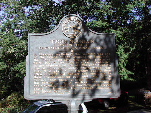
In Cherokee mythology the mountain was one of the homes of the Nunnehi or Immortals, the `People Who Live Anywhere,` a race of Spirit People who lived in great townhouses in the highlands of the...
- lat34
Davenport Mountain

Davenport Mountain in view to the east was named for John Davenport who came to this section in 1838. He built his 40 foot long log house 1/2 mi. to the east over the peak of the mountain....
- lat34
Track Rock Gap

One of the best-known of the petroglyph, or marked stone, sites in Georgia. The six table-sized soapstone boulders contain hundreds of symbols carved or pecked into their surface. Archaeologists...
- lat34
Arthur Fort, 1750-1833
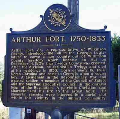
Arthur Fort, Sr., a representative of Wilkinson County, introduced the Bill in the Georgia Legislature to carve a new county out of Wilkinson County territory which became an Act on December 14,...
- lat34
Battle of Griswoldville

Colonel Charles Colcock Jones, General Hardee's Chief of Artillery. summarized the Battle of Griswoldville: "This engagement, while it reflects great credit upon the gallantry of the...
- lat34
Rev. Vincent A. Tharp Home (1809)

This historic house, built for Rev. V. A. Tharp by his sons, John and Charnick, with slave labor in 1809, is the oldest known house in Twiggs County, then Wilkinson. The Tharp family, who...
- lat34
Twiggs County

Twiggs County was created by Act of Dec. 14, 1809 from Wilkinson County. It was named for Gen. John Twiggs (1750-1816), born in Maryland, resident of Burke County, a leader in the Revolution...
- lat34
Ezekiel Wimberley

Major General Ezekiel Wimberly commanding the Twiggs Militia erected and garrisoned three forts along the Ocmulgee River for frontier protection. Born in Bertie County, North Carolina,...
- lat34
Stone Creek Baptist Church-1808

Constituted September 3, 1808, this Church was first located two miles from here on a rocky hill overlooking Stone Creek, a tributary of the Ocmulgee. In 1842 the meetings were moved to an Academy...
- lat34
Dudley M. Hughes

"Magnolia Plantation" was the home of Dudley Mays Hughes, four times a member of Congress from 1909 to 1917. He was the co-author of the Smith ~ Hughes Vocational Education Bill which was...
- lat34
Richland Baptist Church
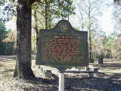
Richland Baptist Church was constituted Oct 5, 1811 with 4 male and 8 female members. The first pastor was Rev. Micajah Fulghum. In June 1861 the ladies of this church made and presented...
- lat34
Battle of Griswoldville: The Big Picture
![On Nov. 15, 1864, [Union] Maj. Gen. W.T. Sherman left Atlanta on his devastating `march to the Sea.` His force divided into two wings and feinted toward Macon and Augusta while on their way to the...](http://lh3.googleusercontent.com/6t-qXg4OODhLkF4MDVgqgdcNJ6pQ1zHg2S5k0qWo35BmJIb-aEcJbCJMegfuL0gUBmkoHAmpOJBx-TBMepLHbLodpNUo)
On Nov. 15, 1864, [Union] Maj. Gen. W.T. Sherman left Atlanta on his devastating `march to the Sea.` His force divided into two wings and feinted toward Macon and Augusta while on their way to...
- lat34
Geographic Center of Georgia

One and one tenth mile south ~ southeast from this marker is the geographic center of the state. The center is defined as the balance point of a plane or thin sheet of a uniform thickness in the...
- lat34
Tarversville

This settlement was named for the Tarver family who settled here more than a century ago. In 1826 a post office was opened as Tarver´s Store and in 1831 the name was changed to...
- lat34
Marion
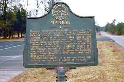
Marion, incorporated in 1816, was the first county seat of Twiggs County. Named for General Francis Marion, the Revolutionary `Swamp Fox`, it was a trading center and metropolis in ante bellum...
- lat34
Turner County

This County, created by Act of the Legislature August 18, 1905, is named for Capt. Henry Gray Turner who was captured by Union troops at Gettysburg. A resident of Nashville and later of Quitman,...
- lat34
Tenth Street School

Constructed in 1931, Tenth Street School provided an education for African-Americans in all grades. Over the years, graduates distinguished themselves in education, law, medicine, religion,...
- lat34
William Hogan Plantation

William Hogan, born January 20, 1804, established a plantation in the 1830´s encompassing much of the present town of Hogansville. When he gave the right-of-way to the railroad in 1849,...
- lat34
Troup Factory

Troup Factory, first cotton mill in Troup County, Georiga, was established in 1846 on Flat Shoals Creek by Robertson, Leslie & Co., of Meriwether County. Water powered carding, spinning...
- lat34