
EARLY TRANS-CATAWBA HISTORY
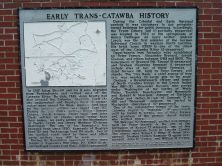
Plaque via North Carolina Highway Historical Marker Program, and is used with their permission. Full page here (NC Marker ID OO1)
- ncmarkers
- north carolina
BUNKER HILL COVERED BRIDGE
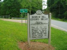
One of the last surviving covered bridges in North Carolina, built in 1894, stands 500 yards north on Lyles Creek.Plaque via North Carolina Highway Historical Marker Program, and is used with...
- ncmarkers
- north carolina
CALVARY CHURCH EPISCOPAL

Built 1859. Grave of "Bill" Nye. Memorials to many famous southerners.Plaque via North Carolina Highway Historical Marker Program, and is used with their permission. Full page here (NC Marker ID P1)
- ncmarkers
- north carolina
MARTIN'S SURRENDER

Gen. James G. Martin surrendered District of Western North Carolina, the last Confederate forces in the state, May 7, 1865, in Waynesville.Plaque via North Carolina Highway Historical Marker...
- ncmarkers
- north carolina
NORTH CAROLINA-SOUTH CAROLINA

NORTH CAROLINA / Colonized, 1585-87, by first English settlers in America; permanently settled c. 1650; first to vote readiness for independence, Apr. 12, 1776 b/w SOUTH CAROLINA / Formed in...
- ncmarkers
- north carolina
BINGHAM SCHOOL

A boys' military school, operated by Robert Bingham, 1891-1928. Moved from Mebane. Campus was 1 mile S.W.Plaque via North Carolina Highway Historical Marker Program, and is used with...
- ncmarkers
- north carolina
THOMAS WOLFE
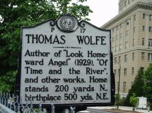
Author of "Look Homeward Angel" (1929), "Of Time and the River," and other works. Home stands 200 yards N., birthplace 500 yds. N.E.Plaque via North Carolina Highway Historical Marker Program, and...
- ncmarkers
- north carolina
NEWTON ACADEMY

Established before 1793 as Union Hill Academy. Named for Rev. George Newton. Present Newton Academy School is 4th building on this site.Plaque via North Carolina Highway Historical Marker Program,...
- ncmarkers
- north carolina
MORNING STAR CHURCH
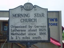
Organized by German Lutherans about 1825; Methodist since 1866. Is 2 1/2 miles south.Plaque via North Carolina Highway Historical Marker Program, and is used with their permission. Full page here...
- ncmarkers
- north carolina
ZEBULON B. VANCE 1830-1894
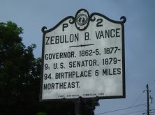
Civil War governor. He led state, 1862-65, and 1877-79; U.S. Senator, 1879-94. Colonel, 26th N.C. Regiment, 1861-62. Birthplace 6 miles N.E.Plaque via North Carolina Highway Historical...
- ncmarkers
- north carolina
FRENCH BROAD BAPTIST CHURCH

Organized before 1792. Present building is here. First building stood 1 mile south.Plaque via North Carolina Highway Historical Marker Program, and is used with their permission. Full page here...
- ncmarkers
- north carolina
ANDRE MICHAUX
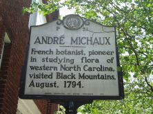
French botanist, pioneer in studying flora of western North Carolina, visited Black Mountains, August, 1794.Plaque via North Carolina Highway Historical Marker Program, and is used with...
- ncmarkers
- north carolina
LOCKE CRAIG

1860-1924 Governor, 1913-1917. He created the state highway & fisheries commissions, est. Mt. Mitchell State Park. Lived 1/2 mi. W.Plaque via North Carolina Highway Historical Marker Program, and...
- ncmarkers
- north carolina
HOT SPRINGS
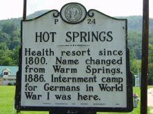
Health resort since 1800. Name changed from Warm Springs, 1886. Internment camp for Germans in World War I was here.Plaque via North Carolina Highway Historical Marker Program, and is used with...
- ncmarkers
- north carolina
VANCE-CARSON DUEL

On Nov. 5, 1827, Robert B. Vance, former N.C. Congressman, was fatally wounded in a duel by Samuel P. Carson, his successor. 1/2 mile S.E.Plaque via North Carolina Highway Historical Marker...
- ncmarkers
- north carolina
FELIX WALKER

Revolutionary officer, member Congress, 1817-23, where, in "talking for Buncombe" (County), he gave new meaning to the word. Home was 1/2 mi. N.Plaque via North Carolina Highway Historical...
- ncmarkers
- north carolina
PAINT ROCK

Pictographs on cliff face were created by Indians ca. 2500 B.C. & long have been landmark for travelers. 5 1/2 mi. N.W.Plaque via North Carolina Highway Historical Marker Program, and is used with...
- ncmarkers
- north carolina
GUN SHOP AND FORGE

Iron works set up four mi. W. by Philip Sitton after 1804. Source for manufacture of rifles by Philip Gillespie. Both operated to 1860s.Plaque via North Carolina Highway Historical Marker Program,...
- ncmarkers
- north carolina
LEE'S SCHOOL 1846-1879
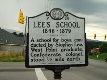
A school for boys, conducted by Stephen Lee, West Point graduate, Confederate colonel, stood 1/2 mile north.Plaque via North Carolina Highway Historical Marker Program, and is used with...
- ncmarkers
- north carolina
RIVERSIDE CEMETERY
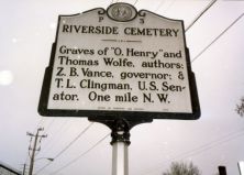
Graves of Thomas Wolfe & "O. Henry," authors; Zebulon B. Vance, governor; Thomas L. Clingman and Robert R. Reynolds, U.S. senators. One-half mile W.Plaque via North Carolina Highway...
- ncmarkers
- north carolina