Battery Wiltsie
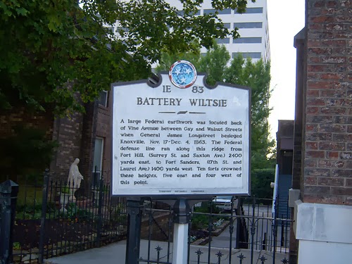
1E 83
BATTERY WILTSIE
A large Federal earthwork was located back
of Vine Avenue between Gay and Walnut Streets
when General James Longstreet besieged
Knoxville, Nov. 17- Dec. 4, 1863. The Federal
defense line ran along this ridge from
Fort Hill, (Surrey Street and Saxton Avenue) 2400
yards east, to Fort Sanders, (17th St. and
Laurel Ave.) 1400 yards west. Ten forts crowned
these heights, five east and four west of
this point.